
I make maps!
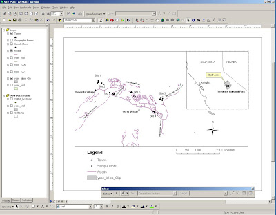
The top one is a study site map for a project I'm working on in which we will simulate different types of fires that could burn the Yosemite Valley. The results will be used to help managers and the Forest Service restore the natural fire conditions (aka "pre smokey the bear") and open up the gorgeous views that have been overgrown with lots of little brushy trees since we (humans) started suppressing small wildfires.
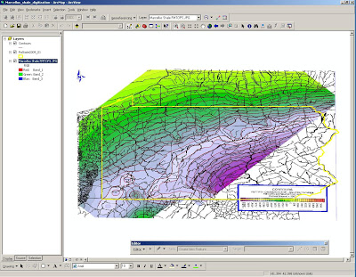
The bottom is a map of Pennsylvania; the contour lines (aka pretty color stripes) show the depth of shale deposits below ground that contain lots of natural gas. I am digitizing the contour lines (aka turning them into digital data on the software program) so the picture can be turned into a 3D model.
The software that geographers use to display and analyze "spatial data" like all this stuff is called ArcGIS (GIS="geographic information system")
It is NOT just a pretty map-making program.
It's like the spatial equivalent of Excel or SPSS.
All the symbols and layers of information that you plug into the data frame are linked to a table that displays the attributes (aka location, size, demographic data, anything) and you can use this data for different types of spatial and statistical analyses.
For instance, last year I did a project comparing population growth in cities across the U.S. to water use over the past 10-20 years to see where population growth was most affecting water scarcity.
The top reason why I love geography is that I am an EXTREMELY VISUAL person.
I love being able to see where things are, how they are distributed, and understand problems through a broad spatial scale.
Landscapes, not microscopes!